Geolocate

Laserna topographic map

Click on the map to display elevation.

About this map

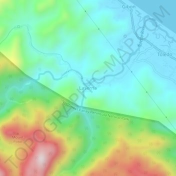
Name: Laserna topographic map, elevation, terrain.

Location: Laserna, Nabas, Aklan, Western Visayas, Philippines (11.81952 122.01633 11.85952 122.05633)

Average elevation: 198 m

Minimum elevation: 0 m

Maximum elevation: 674 m

Other topographic maps

Click on a map to view its topography, its elevation and its terrain.

Poblacion Park

Philippines > Aklan > Nabas

Average elevation: 5 m

Gear up for your next adventure:

🥾Hiking Boots - Sturdy boots providing ankle support and traction on rugged trails
🥤Collapsible Travel Cup - Saves space and weight in your mess kit
🥾Hiking Shorts - Breathable shorts suitable for summer hikes
🧦Merino Wool Socks - Moisture-wicking comfort for long-distance hiking
🧥Waterproof Pants - Keep dry during rainy hiking conditions

As an Amazon Associate, this site earns from qualifying purchases at no extra cost to you.