Geolocate

Hochkar topographic map

Click on the map to display elevation.

About this map

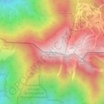
Name: Hochkar topographic map, elevation, terrain.

Location: Hochkar, Wildalpen, Bezirk Liezen, Styria, 8924, Austria (47.71078 14.90116 47.71088 14.90126)

Average elevation: 1,354 m

Minimum elevation: 787 m

Maximum elevation: 1,783 m

Gear up for your next adventure:

🧦Crew Hiking Socks - Comfortable socks for long-distance hikes
🔦UV Flashlight - Detect minerals or specific insects in the dark
🪜Heavy Duty Carabiners - Multi-use clips for securing gear to your backpack
🥾Trail Hiking Socks - Comfortable socks to prevent blisters and fatigue
👟Trail Running Shoes - Agile footwear for fast-paced topographic exploration

As an Amazon Associate, this site earns from qualifying purchases at no extra cost to you.