Geolocate

Gurgo topographic map

Click on the map to display elevation.

About this map

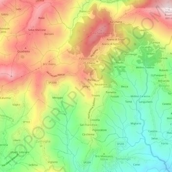
Name: Gurgo topographic map, elevation, terrain.

Location: Gurgo, Pettinengo, Biella, Piemonte, 13848, Italia (45.58665 8.08373 45.62665 8.12373)

Average elevation: 580 m

Minimum elevation: 325 m

Maximum elevation: 867 m

Gear up for your next adventure:

🧭GPS Tracker - Track your location in remote areas safely
🛶Kayak Accessories - Essential gear for safe and fun kayaking adventures
🪜Heavy Duty Carabiners - Multi-use clips for securing gear to your backpack
🧴Waterproofing Spray - Restore the DWR coating on jackets and tents
🥾Waterproof Trail Shoes - Shoes designed to handle wet terrain

As an Amazon Associate, this site earns from qualifying purchases at no extra cost to you.