Geolocate

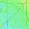
Piestewa Peak topographic map

Click on the map to display elevation.

About this map

Name: Piestewa Peak topographic map, elevation, terrain.

Location: Piestewa Peak, Phoenix, Maricopa County, Arizona, 85036, United States (33.54761 -112.02112 33.54771 -112.02102)

Average elevation: 499 m

Minimum elevation: 385 m

Maximum elevation: 758 m

Other topographic maps

Click on a map to view its topography, its elevation and its terrain.

Deer Valley

United States > Arizona > Maricopa County > Phoenix

Average elevation: 441 m

Bird Lake

United States > Arizona > Maricopa County > Phoenix

Average elevation: 345 m

Papago Park

United States > Arizona > Maricopa County > Phoenix

The Ponds have a surface area of 6 acres (2.4 ha) with an average depth of 8 ft (2.4 m), the elevation of the area is 1,100 ft (340 m).

Average elevation: 383 m
Sumida Park

United States > Arizona > Maricopa County > Phoenix

Average elevation: 403 m

New River

United States > Arizona > Maricopa County > Phoenix

Average elevation: 690 m

Gear up for your next adventure:

🛶Kayak Accessories - Essential gear for safe and fun kayaking adventures
🥾Trail Hiking Socks - Comfortable socks to prevent blisters and fatigue
🧴First Aid Kit - Essential first aid supplies for outdoor emergencies
⛺Bushcraft Tarp - Versatile emergency shelter or gear protection
🛁Quick-Dry Microfiber Towel - Space-saving towel that dries rapidly on the move

As an Amazon Associate, this site earns from qualifying purchases at no extra cost to you.