Geolocate

Kukusan topographic map

Click on the map to display elevation.

About this map

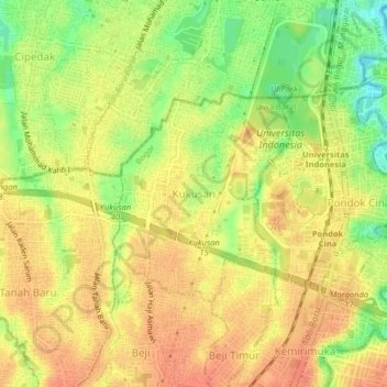
Name: Kukusan topographic map, elevation, terrain.

Location: Kukusan, Depok, West Java, 16425, Indonesia (-6.38605 106.79816 -6.34605 106.83816)

Average elevation: 72 m

Minimum elevation: 43 m

Maximum elevation: 87 m

Gear up for your next adventure:

🥾All-Terrain Hiking Boots - Versatile boots for varied hiking conditions
🧥Packable Rain Jacket - Breathable waterproof layer for unpredictable weather
🧦Crew Hiking Socks - Comfortable socks for long-distance hikes
🩹Compact First Aid Kit - Pre-packed essentials for common trail injuries
🔭Outdoor Binoculars - Lightweight binoculars for birdwatching and hiking

As an Amazon Associate, this site earns from qualifying purchases at no extra cost to you.