Liangshan Yi Autonomous Prefecture topographic map
Click on the map to display elevation.
Liangshan Yi Autonomous Prefecture
Owing to its low latitude and high elevation, Liangshan has a mild climate. Under the Köppen system, the prefecture belongs to the humid subtropical zone (Köppen Cwa). Winters feature mild days and cool nights, while summers are very warm and humid. Monthly daily mean temperatures range from 9.6 °C (49.3 °F) in January to 22.3 °C (72.1 °F) in July. Unlike much of the province, which lies in the Sichuan Basin, humidity levels in winter are rather low, but like the rest of the province, rainfall is concentrated in the months of June through September, and the prefecture is virtually rainless in winter.
About this map
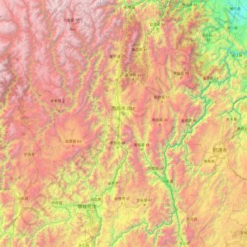
Name: Liangshan Yi Autonomous Prefecture topographic map, elevation, terrain.
Location: Liangshan Yi Autonomous Prefecture, Sichuan, China (26.04817 100.16675 29.30544 103.87517)
Average elevation: 2,439 m
Minimum elevation: 312 m
Maximum elevation: 5,740 m
Other topographic maps
Click on a map to view its topography, its elevation and its terrain.
Jiuzhaigou
China > Sichuan > Jiuzhaigou County > Jiuzhaigou
The Jiuzhaigou valley is part of the Min Mountains on the edge of the Tibetan Plateau and stretches over 72,000 hectares (180,000 acres). It is known for its many multi-level waterfalls, colorful lakes, and snow-capped peaks. Its elevation ranges from 2,000 to 4,500 metres (6,600 to 14,800 ft).
Average elevation: 2,552 m
Xichang
China > Sichuan > Xichang City > Beicheng Subdistrict
Owing to its low latitude and high elevation, Xichang has a monsoon-influenced humid subtropical climate (Köppen Cwa) milder and far sunnier than the Sichuan Basin, with mild, very sunny and dry winters, and very warm, rainy summers. The monthly 24-hour average temperature ranges from 9.9 °C (49.8 °F) in…
Average elevation: 1,970 m
Mount Gongga
China > Sichuan > Luding County
Mount Gongga (simplified Chinese: 贡嘎山; traditional Chinese: 貢嘎山; pinyin: Gònggá Shān), also known as Minya Konka (Khams Tibetan pinyin: Mi'nyâg Gong'ga Riwo) and colloquially as "The King of Sichuan Mountains", is the highest mountain in Sichuan province, China. It has an elevation of 7,556 m…
Average elevation: 6,496 m