
Make a donation
Gear up for your next adventure:
As an Amazon Associate, this site earns from qualifying purchases at no extra cost to you.
Stark City topographic map
Click on the map to display elevation.
Make a donation
Gear up for your next adventure:
As an Amazon Associate, this site earns from qualifying purchases at no extra cost to you.
About this map
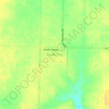
Name: Stark City topographic map, elevation, terrain.
Location: Stark City, Newton County, Missouri, United States (36.85839 -94.19239 36.86218 -94.18382)
Average elevation: 373 m
Minimum elevation: 357 m
Maximum elevation: 382 m
Make a donation
Gear up for your next adventure:
As an Amazon Associate, this site earns from qualifying purchases at no extra cost to you.
Other topographic maps
Click on a map to view its topography, its elevation and its terrain.
Shoal Creek
United States > Missouri > Newton County > Joplin > Cliff Village
Average elevation: 295 m
Make a donation
Gear up for your next adventure:
As an Amazon Associate, this site earns from qualifying purchases at no extra cost to you.