
Cheongnyongsan Mountain topographic map
Interactive map
Click on the map to display elevation.
About this map
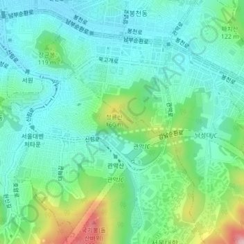
Name: Cheongnyongsan Mountain topographic map, elevation, terrain.
Average elevation: 78 m
Minimum elevation: 25 m
Maximum elevation: 234 m
Other topographic maps
Click on a map to view its topography, its elevation and its terrain.
Seoul
South Korea > Seoul > Gwanak-gu
Sillim-dong, Gwanak-gu, Seoul, South Korea
Average elevation: 45 m