Geolocate

Canyelles topographic map

Click on the map to display elevation.

About this map
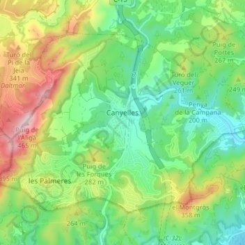
Name: Canyelles topographic map, elevation, terrain.

Location: Canyelles, Garraf, Barcelona, Catalonia, 08811, Spain (41.26628 1.69030 41.30134 1.75413)

Average elevation: 210 m

Minimum elevation: 74 m

Maximum elevation: 460 m

Other topographic maps

Click on a map to view its topography, its elevation and its terrain.
Gear up for your next adventure:

🚲Bike Repair Kit - Essential tools for on-trail mechanical issues
🧦Hiking Liner Socks - Thin base layer to prevent friction and blisters
🥾Trail Hiking Boots - Supportive boots for rough trails
🔋Emergency Crank Radio - Weather alerts and power without needing batteries
🧊Insulated Water Bottle - Keeps drinks cold in summer and prevents freezing in winter

As an Amazon Associate, this site earns from qualifying purchases at no extra cost to you.