
Linesville topographic map
Click on the map to display elevation.
About this map
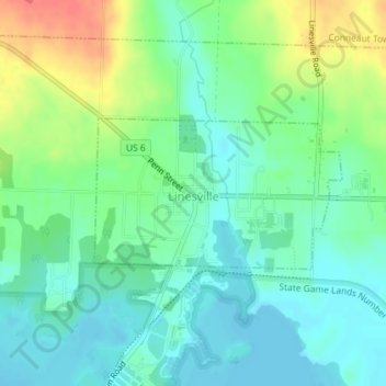
Name: Linesville topographic map, elevation, terrain.
Location: Linesville, Crawford County, Pennsylvania, United States (41.65107 -80.43324 41.66163 -80.41004)
Average elevation: 325 m
Minimum elevation: 305 m
Maximum elevation: 367 m
Other topographic maps
Click on a map to view its topography, its elevation and its terrain.