
Mărișel topographic map
Interactive map
Click on the map to display elevation.
About this map
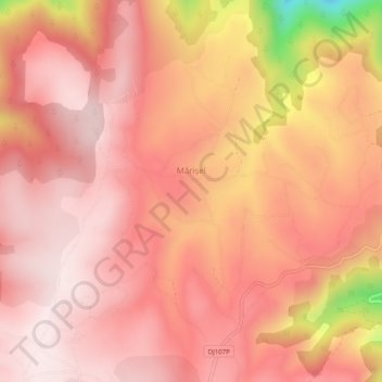
Name: Mărișel topographic map, elevation, terrain.
Location: Mărișel, Cluj, Roumanie (46.66594 23.08781 46.69646 23.13791)
Average elevation: 1,151 m
Minimum elevation: 784 m
Maximum elevation: 1,273 m
Other topographic maps
Click on a map to view its topography, its elevation and its terrain.