Geolocate

Challhuayaco topographic map

Click on the map to display elevation.

About this map

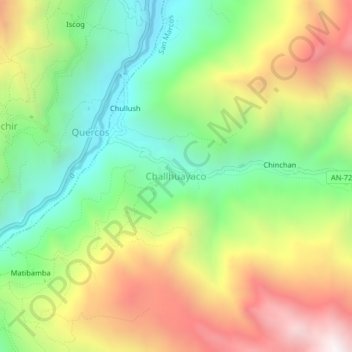
Name: Challhuayaco topographic map, elevation, terrain.

Location: Challhuayaco, San Marcos, Huari, Áncash, Perú (-9.64219 -77.19566 -9.60219 -77.15566)

Average elevation: 3,723 m

Minimum elevation: 3,162 m

Maximum elevation: 4,484 m

Other topographic maps

Click on a map to view its topography, its elevation and its terrain.

Presa de Relaves de Antamina

Perú > Áncash > San Marcos

Average elevation: 4,145 m

Gear up for your next adventure:

🧢Outdoor Cap - Protective cap for sun and rain during hikes
Tent Footprint - Protect tent floor and increase durability
🧰Emergency Multi-Tool - Compact multi-tool for outdoor survival
🚲Handlebar Phone Mount - View topographic-map.com live while cycling
🧴First Aid Kit - Essential first aid supplies for outdoor emergencies

As an Amazon Associate, this site earns from qualifying purchases at no extra cost to you.