
Thank you for supporting this site ❤️
Make a donation
Make a donation
Gear up for your next adventure:
As an Amazon Associate, this site earns from qualifying purchases at no extra cost to you.
Bourgoun topographic map
Click on the map to display elevation.
Thank you for supporting this site ❤️
Make a donation
Make a donation
Gear up for your next adventure:
As an Amazon Associate, this site earns from qualifying purchases at no extra cost to you.
About this map
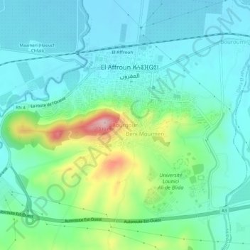
Name: Bourgoun topographic map, elevation, terrain.
Location: Bourgoun, El Affroun, Daïra El Affroun, Blida, 09011, Algérie (36.44113 2.60587 36.48113 2.64587)
Average elevation: 138 m
Minimum elevation: 83 m
Maximum elevation: 316 m
Thank you for supporting this site ❤️
Make a donation
Make a donation
Gear up for your next adventure:
As an Amazon Associate, this site earns from qualifying purchases at no extra cost to you.