Geolocate

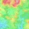
Lardiller topographic map

Click on the map to display elevation.

About this map

Name: Lardiller topographic map, elevation, terrain.

Location: Lardiller, Saint-Hilaire-le-Château, Guéret, Creuse, Nouvelle-Aquitaine, France métropolitaine, 23250, France (45.96839 1.88618 46.00839 1.92618)

Average elevation: 504 m

Minimum elevation: 446 m

Maximum elevation: 593 m

Other topographic maps

Click on a map to view its topography, its elevation and its terrain.
Gear up for your next adventure:

👟Trail Running Shoes - Agile footwear for fast-paced topographic exploration
🥾Trail Running Boots - Durable shoes designed for trail running
❄️Traction Ice Cleats - Slip-on spikes for icy trails and winter hiking
🕯️Camping Lantern - Illuminates your entire campsite with high-efficiency LEDs
🛏️Camping Sleeping Mat - Comfortable mats for sleeping outdoors

As an Amazon Associate, this site earns from qualifying purchases at no extra cost to you.