Geolocate

Valdellette topographic map

Click on the map to display elevation.

About this map

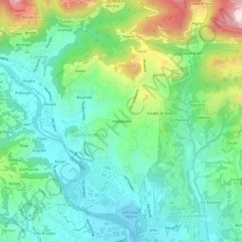
Name: Valdellette topographic map, elevation, terrain.

Location: Valdellette, Lugo di Vicenza, Vicenza, Veneto, 36030, Italy (45.73522 11.51159 45.77522 11.55159)

Average elevation: 265 m

Minimum elevation: 127 m

Maximum elevation: 610 m

Gear up for your next adventure:

🥾Waterproof Hiking Shoes - Durable shoes for wet and rugged trails
🛏️Camping Sleeping Mat - Comfortable mats for sleeping outdoors
🥾Trail Running Shoes - Lightweight and durable shoes for trail running
Lightweight Backpacking Tent - Compact tent for efficient hiking trips
🧥Ultralight Puffy Jacket - Maximum warmth that packs down to the size of an orange

As an Amazon Associate, this site earns from qualifying purchases at no extra cost to you.