
Thank you for supporting this site ❤️
Make a donation
Make a donation
Gear up for your next adventure:
As an Amazon Associate, this site earns from qualifying purchases at no extra cost to you.
Kagio topographic map
Click on the map to display elevation.
Thank you for supporting this site ❤️
Make a donation
Make a donation
Gear up for your next adventure:
As an Amazon Associate, this site earns from qualifying purchases at no extra cost to you.
About this map
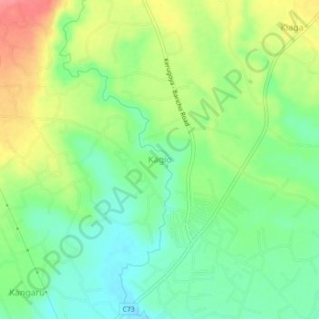
Name: Kagio topographic map, elevation, terrain.
Location: Kagio, Kirinyaga County, Central Kenya, Kenya (-0.63660 37.23000 -0.59660 37.27000)
Average elevation: 1,245 m
Minimum elevation: 1,214 m
Maximum elevation: 1,291 m
Thank you for supporting this site ❤️
Make a donation
Make a donation
Gear up for your next adventure:
As an Amazon Associate, this site earns from qualifying purchases at no extra cost to you.