
Thank you for supporting this site ❤️
Make a donation
Make a donation
Gear up for your next adventure:
As an Amazon Associate, this site earns from qualifying purchases at no extra cost to you.
Mexico topographic map
Click on the map to display elevation.
Thank you for supporting this site ❤️
Make a donation
Make a donation
Gear up for your next adventure:
As an Amazon Associate, this site earns from qualifying purchases at no extra cost to you.
About this map
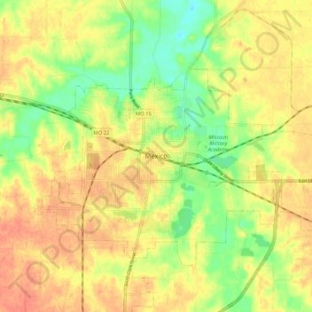
Name: Mexico topographic map, elevation, terrain.
Location: Mexico, Audrain County, Missouri, 65265, United States (39.12976 -91.92295 39.20976 -91.84295)
Average elevation: 242 m
Minimum elevation: 216 m
Maximum elevation: 259 m
Thank you for supporting this site ❤️
Make a donation
Make a donation
Gear up for your next adventure:
As an Amazon Associate, this site earns from qualifying purchases at no extra cost to you.