Geolocate

Kurungdahu topographic map

Click on the map to display elevation.

About this map

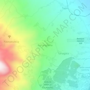
Name: Kurungdahu topographic map, elevation, terrain.

Location: Kurungdahu, Pandeglang, Banten, Java, 42251, Indonesia (-6.28496 106.07798 -6.24496 106.11798)

Average elevation: 445 m

Minimum elevation: 211 m

Maximum elevation: 956 m

Other topographic maps

Click on a map to view its topography, its elevation and its terrain.

Tanjungjaya

Indonesia > Banten > Pandeglang

Average elevation: 37 m

Tanjungjaya

Indonesia > Banten > Pandeglang

Average elevation: 37 m

Gear up for your next adventure:

🏃Hydration Running Vest - Carry water and maps close to your body for speed
💡LED Camping Lantern - Illuminate your campsite with long-lasting lanterns
🥾Mountain Trail Shoes - High-traction shoes for mountain trails
🏕️Camping Hammock - Integrated protection for sleeping between trees
🍽️Titanium Camping Spork - Ultralight and indestructible eating utensil

As an Amazon Associate, this site earns from qualifying purchases at no extra cost to you.