
Thank you for supporting this site ❤️
Make a donation
Make a donation
Gear up for your next adventure:
As an Amazon Associate, this site earns from qualifying purchases at no extra cost to you.
Mezgoug topographic map
Click on the map to display elevation.
Thank you for supporting this site ❤️
Make a donation
Make a donation
Gear up for your next adventure:
As an Amazon Associate, this site earns from qualifying purchases at no extra cost to you.
About this map
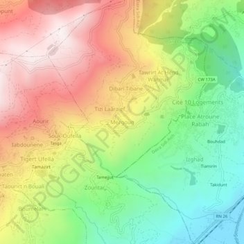
Name: Mezgoug topographic map, elevation, terrain.
Location: Mezgoug, Tibane, Daïra Chemini, Béjaïa, 06730, Algérie (36.58772 4.63005 36.62772 4.67005)
Average elevation: 563 m
Minimum elevation: 90 m
Maximum elevation: 1,097 m
Thank you for supporting this site ❤️
Make a donation
Make a donation
Gear up for your next adventure:
As an Amazon Associate, this site earns from qualifying purchases at no extra cost to you.