
Thank you for supporting this site ❤️
Make a donation
Make a donation
Gear up for your next adventure:
As an Amazon Associate, this site earns from qualifying purchases at no extra cost to you.
Litchfield topographic map
Click on the map to display elevation.
Thank you for supporting this site ❤️
Make a donation
Make a donation
Gear up for your next adventure:
As an Amazon Associate, this site earns from qualifying purchases at no extra cost to you.
About this map
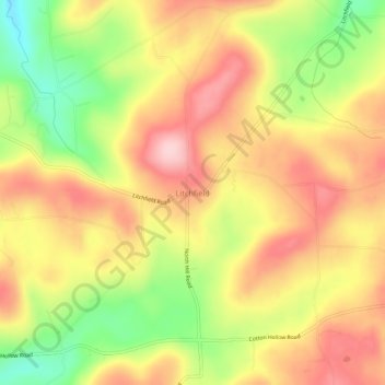
Name: Litchfield topographic map, elevation, terrain.
Location: Litchfield, Bradford County, Pennsylvania, United States (41.94757 -76.45022 41.98757 -76.41022)
Average elevation: 421 m
Minimum elevation: 305 m
Maximum elevation: 511 m
Thank you for supporting this site ❤️
Make a donation
Make a donation
Gear up for your next adventure:
As an Amazon Associate, this site earns from qualifying purchases at no extra cost to you.