Geolocate

Marganell topographic map

Click on the map to display elevation.

About this map

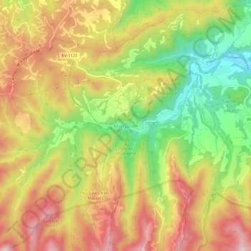
Name: Marganell topographic map, elevation, terrain.

Location: Marganell, Bages, Barcelona, Cataluña, 08253, España (41.62067 1.77002 41.66067 1.81002)

Average elevation: 406 m

Minimum elevation: 226 m

Maximum elevation: 569 m

Gear up for your next adventure:

Camping Essentials - All-in-one gear for a comfortable camping trip
🔨Vehicle Emergency Tool - Safety tool for remote road trips to trailheads
🥾Lightweight Hiking Boots - Boots for comfort and mobility on long hikes
🧥Ultralight Puffy Jacket - Maximum warmth that packs down to the size of an orange
🧳Compression Sacks - Maximize space in your backpack by shrinking gear

As an Amazon Associate, this site earns from qualifying purchases at no extra cost to you.