Geolocate

Hauzenberg topographic map

Click on the map to display elevation.

About this map

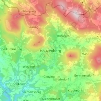
Name: Hauzenberg topographic map, elevation, terrain.

Location: Hauzenberg, Landkreis Passau, Bayern, 94051, Deutschland (48.61520 13.58768 48.69520 13.66768)

Average elevation: 595 m

Minimum elevation: 356 m

Maximum elevation: 949 m

Gear up for your next adventure:

🥾Waterproof Hiking Shoes - Durable shoes for wet and rugged trails
👟Sport Hiking Sandals - Breathable footwear for water crossings and camp rest
💡LED Camping Lantern - Illuminate your campsite with long-lasting lanterns
🛁Quick-Dry Microfiber Towel - Space-saving towel that dries rapidly on the move
📷Outdoor Action Camera - Capture high-elevation views and rugged adventures

As an Amazon Associate, this site earns from qualifying purchases at no extra cost to you.