
Thank you for supporting this site ❤️
Make a donation
Make a donation
Gear up for your next adventure:
As an Amazon Associate, this site earns from qualifying purchases at no extra cost to you.
Borralha topographic map
Click on the map to display elevation.
Thank you for supporting this site ❤️
Make a donation
Make a donation
Gear up for your next adventure:
As an Amazon Associate, this site earns from qualifying purchases at no extra cost to you.
About this map
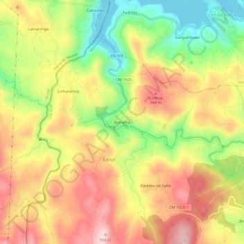
Name: Borralha topographic map, elevation, terrain.
Location: Borralha, Salto, Montalegre, Vila Real, 5470-409, Portugal (41.63544 -8.00046 41.67544 -7.96046)
Average elevation: 845 m
Minimum elevation: 683 m
Maximum elevation: 989 m
Thank you for supporting this site ❤️
Make a donation
Make a donation
Gear up for your next adventure:
As an Amazon Associate, this site earns from qualifying purchases at no extra cost to you.