Geolocate

Warmond topographic map

Click on the map to display elevation.

About this map

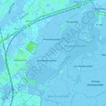
Name: Warmond topographic map, elevation, terrain.

Location: Warmond, Teylingen, South Holland, Netherlands (52.17969 4.48774 52.22233 4.56170)

Average elevation: 0 m

Minimum elevation: -6 m

Maximum elevation: 6 m

Gear up for your next adventure:

🧣Evaporative Cooling Towel - Beat the heat during intense summer climbs
🧢Outdoor Visor - Breathable visor for sunny hikes
🪑Ultralight Camping Stool - Compact seating for rest stops during long hikes
🛶Canoe Life Vest - Safety vest for water sports
🧭GPS Outdoor Watch - Smart watch for navigation and fitness tracking in nature

As an Amazon Associate, this site earns from qualifying purchases at no extra cost to you.