Geolocate

Coterillo topographic map

Click on the map to display elevation.

About this map
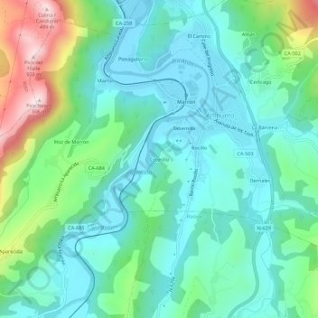
Name: Coterillo topographic map, elevation, terrain.

Location: Coterillo, Ampuero, Asón-Agüera, Cantabria, 39849, España (43.31847 -3.44570 43.35847 -3.40570)

Average elevation: 122 m

Minimum elevation: 2 m

Maximum elevation: 493 m

Gear up for your next adventure:

🥾Mountain Trail Shoes - High-traction shoes for mountain trails
🪑Ultralight Camping Stool - Compact seating for rest stops during long hikes
🧢Outdoor Cap - Protective cap for sun and rain during hikes
🔦LED Headtorch - Bright and durable light for night activities
👟Leg Gaiters - Keep debris, mud, and snow out of your boots

As an Amazon Associate, this site earns from qualifying purchases at no extra cost to you.