Geolocate

Pueblo topographic map

Click on the map to display elevation.

About this map

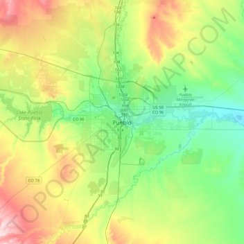
Name: Pueblo topographic map, elevation, terrain.

Location: Pueblo, Pueblo County, Colorado, 81003, United States (38.09445 -104.76914 38.41445 -104.44914)

Average elevation: 1,509 m

Minimum elevation: 1,379 m

Maximum elevation: 1,767 m

Gear up for your next adventure:

🔭Compact Monocular - One-handed bird watching and trail spotting
🚲Heavy Duty Bike Lock - Secure your bike at the trailhead or during stops
🧭GPS Outdoor Watch - Smart watch for navigation and fitness tracking in nature
🧥Softshell Hiking Jacket - The perfect balance of wind protection and breathability
🧴Sunscreen SPF - Broad-spectrum sunscreen for outdoor activities

As an Amazon Associate, this site earns from qualifying purchases at no extra cost to you.