Geolocate

Pandora topographic map

Click on the map to display elevation.

About this map

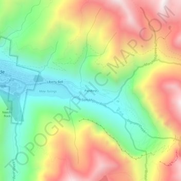
Name: Pandora topographic map, elevation, terrain.

Location: Pandora, San Miguel County, Colorado, 81435, United States (37.91333 -107.80562 37.95333 -107.76562)

Average elevation: 3,174 m

Minimum elevation: 2,667 m

Maximum elevation: 3,816 m

Gear up for your next adventure:

🧢Hiking Sun Hat - Wide-brimmed protection for exposed mountain ridges
🧢Sun Hat - Wide-brim hat for sun protection
🎒Fully Waterproof Backpack - Total protection for photography gear and electronics
🔨Vehicle Emergency Tool - Safety tool for remote road trips to trailheads
🧦Hiking Liner Socks - Thin base layer to prevent friction and blisters

As an Amazon Associate, this site earns from qualifying purchases at no extra cost to you.