Geolocate

Las Palma topographic map

Click on the map to display elevation.

About this map

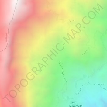
Name: Las Palma topographic map, elevation, terrain.

Location: Las Palma, Macaravita, García Rovira, Santander, Colombia (6.50933 -72.60818 6.52933 -72.58818)

Average elevation: 2,722 m

Minimum elevation: 2,073 m

Maximum elevation: 3,304 m

Gear up for your next adventure:

🎒Hiking Backpack - Lightweight and ergonomic backpacks for day hikes or multi-day treks
🚑Survival Whistle - Signal for help across long distances in mountains
🏃Hydration Running Vest - Carry water and maps close to your body for speed
🥾Waterproof Hiking Boots - Essential footwear for rugged terrain and wet Canadian trails
🚲Handlebar Phone Mount - View topographic-map.com live while cycling

As an Amazon Associate, this site earns from qualifying purchases at no extra cost to you.