Geolocate

Cashmere topographic map

Click on the map to display elevation.

About this map
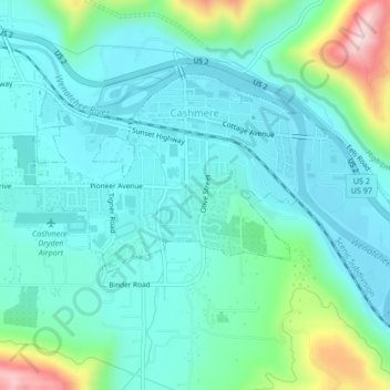
Name: Cashmere topographic map, elevation, terrain.

Location: Cashmere, Chelan County, Washington, United States (47.50746 -120.48868 47.52519 -120.44660)

Average elevation: 298 m

Minimum elevation: 222 m

Maximum elevation: 596 m

Other topographic maps

Click on a map to view its topography, its elevation and its terrain.

Little Bear

United States > Washington > Chelan County

Average elevation: 807 m

Dagger Lake

United States > Washington > Chelan County

Average elevation: 1,845 m

Jay Peak

United States > Washington > Chelan County

Average elevation: 1,829 m

Gear up for your next adventure:

🔥Emergency Fire Starter - Reliable ignition source for all weather conditions
🐕Hiking Dog Pack - Let your canine companion carry their own water and food
🥾Lightweight Hiking Boots - Boots for comfort and mobility on long hikes
🚲Heavy Duty Bike Lock - Secure your bike at the trailhead or during stops
🛶Canoe Life Vest - Safety vest for water sports

As an Amazon Associate, this site earns from qualifying purchases at no extra cost to you.