Geolocate

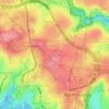
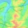
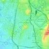
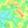
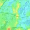
Slidey Park topographic map

Click on the map to display elevation.

About this map

Name: Slidey Park topographic map, elevation, terrain.

Location: Slidey Park, Gables, Hills District, Sydney, The Hills Shire Council, New South Wales, 2765, Australia (-33.63361 150.90555 -33.63082 150.90789)

Average elevation: 47 m

Minimum elevation: 24 m

Maximum elevation: 74 m

Other topographic maps

Click on a map to view its topography, its elevation and its terrain.
Randwick

Australia > New South Wales > Sydney

Average elevation: 44 m

Rouse Hill

Australia > New South Wales > Sydney

Average elevation: 51 m

Lower North Shore

Australia > New South Wales > Sydney

Average elevation: 45 m

Mascot

Australia > New South Wales > Sydney

Average elevation: 8 m

Wentworth Falls

Australia > New South Wales > Sydney

Wentworth Falls (postcode: 2782) is a town in the Blue Mountains region of New South Wales, situated approximately 100 kilometres (62 mi) west of the Sydney central business district, and about 8 kilometres (5.0 mi) east of Katoomba, Australia on the Great Western Highway, with a Wentworth Falls railway…

Average elevation: 708 m
Northern Beaches

Australia > New South Wales > Sydney

Average elevation: 67 m

Lindfield

Australia > New South Wales > Sydney

Average elevation: 79 m

Northbridge

Australia > New South Wales > Sydney

Average elevation: 53 m

Sydney

Australia > New South Wales > Sydney

Average elevation: 23 m

Crows Nest

Australia > New South Wales > Sydney

Average elevation: 68 m

Dolls Point

Australia > New South Wales > Sydney

Average elevation: 3 m

Eastern Suburbs

Australia > New South Wales > Sydney

Average elevation: 12 m

Marrickville

Australia > New South Wales > Sydney

Average elevation: 17 m

St George

Australia > New South Wales > Sydney

Average elevation: 25 m

Sylvania

Australia > New South Wales > Sydney

Average elevation: 19 m

Leichhardt

Australia > New South Wales > Sydney

Average elevation: 22 m

Mount Pritchard

Australia > New South Wales > Sydney

Average elevation: 34 m

Toongabbie

Australia > New South Wales > Sydney

Average elevation: 43 m

Casula

Australia > New South Wales > Sydney

Casula is the first suburb immediately south of Liverpool on the Hume Highway and the Main Southern railway line between Sydney and Melbourne. Casula consists of undulating, gently rolling land, with elevations across the suburb being mostly between 30 and 70 metres above sea level. The Georges River forms the…

Average elevation: 34 m

Ingleburn

Australia > New South Wales > Sydney

Average elevation: 56 m

Waterfall

Australia > New South Wales > Sydney

Average elevation: 178 m

Queenscliff

Australia > New South Wales > Sydney

Average elevation: 14 m

North Head

Australia > New South Wales > Sydney

Average elevation: 22 m

Galston

Australia > New South Wales > Sydney

Average elevation: 167 m

Penrith

Australia > New South Wales > Sydney > Penrith

Penrith is a city in New South Wales, Australia, located in Greater Western Sydney, 55 kilometres (31 mi) west of the Sydney central business district on the banks of the Nepean River, on the outskirts of the Cumberland Plain. Its elevation is 32 metres (105 ft).

Average elevation: 34 m
Hornsby Heights

Australia > New South Wales > Sydney

Average elevation: 146 m

Cronulla

Australia > New South Wales > Sydney

Average elevation: 8 m

Engadine

Australia > New South Wales > Sydney

Average elevation: 121 m

Rosehill

Australia > New South Wales > Sydney

Average elevation: 9 m

Wakeley

Australia > New South Wales > Sydney

Average elevation: 31 m

Woronora

Australia > New South Wales > Sydney

Woronora Plateau, is a geographical region adjacent to the Sydney Plain. Slightly higher in altitude, it is capped with Hawkesbury Sandstone. The Woronora River flows through the deeply dissected plateau to the Georges River from near the sources of the Port Hacking, within the Sutherland Shire.

Average elevation: 65 m

Nelson

Australia > New South Wales > Sydney

Average elevation: 47 m

Baulkham Hills

Australia > New South Wales > Sydney

Average elevation: 93 m

Gladesville

Australia > New South Wales > Sydney

Average elevation: 28 m

Kensington

Australia > New South Wales > Sydney

Average elevation: 31 m

Rozelle

Australia > New South Wales > Sydney

Average elevation: 16 m

Bronte

Australia > New South Wales > Sydney

Average elevation: 42 m

Peakhurst

Australia > New South Wales > Sydney

Average elevation: 32 m

Narrabeen

Australia > New South Wales > Sydney

Average elevation: 17 m

Haberfield

Australia > New South Wales > Sydney

Average elevation: 18 m

Cremorne

Australia > New South Wales > Sydney

Average elevation: 54 m

Vaucluse

Australia > New South Wales > Sydney

Average elevation: 20 m

Gordon

Australia > New South Wales > Sydney

Average elevation: 101 m

Pitt Town

Australia > New South Wales > Sydney

Average elevation: 19 m

Little Bay

Australia > New South Wales > Sydney

Average elevation: 18 m

Allambie Heights

Australia > New South Wales > Sydney

Average elevation: 77 m

Bondi Junction

Australia > New South Wales > Sydney

Average elevation: 63 m

North Sydney

Australia > New South Wales > Sydney

Average elevation: 50 m

Ryde

Australia > New South Wales > Sydney

Average elevation: 52 m

Lane Cove

Australia > New South Wales > Sydney

Average elevation: 52 m

Walsh Bay

Australia > New South Wales > Sydney

Average elevation: 13 m

Box Hill

Australia > New South Wales > Sydney

Average elevation: 45 m

Denistone

Australia > New South Wales > Sydney

Average elevation: 60 m

Bondi Beach

Australia > New South Wales > Sydney

Average elevation: 31 m

Artarmon

Australia > New South Wales > Sydney

Average elevation: 81 m

Lizard Log Park

Australia > New South Wales > Sydney

Average elevation: 77 m

Willoughby

Australia > New South Wales > Sydney

Average elevation: 80 m

Hills District

Australia > New South Wales > Sydney

Average elevation: 91 m

Toongabbie Creek

Australia > New South Wales > Sydney

Average elevation: 52 m

Balls Head

Australia > New South Wales > Sydney

Average elevation: 19 m

Bidwill

Australia > New South Wales > Sydney

Average elevation: 49 m

Middle Head

Australia > New South Wales > Sydney

Average elevation: 9 m

Bullaburra

Australia > New South Wales > Sydney

By 1986, Bruce's Walk had come to the attention of two other walkers, Jim Smith and Wilf Hilder, who organised a group of volunteers to clear the track between Bullaburra and Wentworth Falls. In the process, they found many artefacts and features, including signs, shelter caves, seats and picnic tables. This…

Average elevation: 712 m
Mort's Bay

Australia > New South Wales > Sydney

Average elevation: 10 m

Davidson

Australia > New South Wales > Sydney

Davidson features uneven topography, in large part due to the area's origins as a mining quarry, as well as its proximity to Garigal National Park. Steep descents are evident in Stone Parade, Borgnis Street and Maitland Street, whereas more undulatory landscapes can be seen along parts of Prahran Avenue and…

Average elevation: 98 m
Pennant Hills

Australia > New South Wales > Sydney

The name Pennant Hills originally applied to the area now known as West Pennant Hills, located in the Hills District. However, when the northern railway line was built it passed through what is now Pennant Hills, so a suburb grew around the station and took on the name. The area around Thompsons Corner was…

Average elevation: 146 m

Scotland Island

Australia > New South Wales > Sydney

Average elevation: 17 m

Woodford

Australia > New South Wales > Sydney

Woodford is a village in the Blue Mountains in New South Wales, Australia, about 90 kilometres west of Sydney. Its elevation is 609 metres (1,998 ft) above sea level. It is situated on the Great Western Highway and has a railway station (opened in 1868 as Buss's Platform) on the Main Western railway line…

Average elevation: 544 m
Hurstville

Australia > New South Wales > Sydney

Average elevation: 50 m

Rockdale

Australia > New South Wales > Sydney

Average elevation: 20 m

Bella Vista

Australia > New South Wales > Sydney

Average elevation: 79 m

Waverton

Australia > New South Wales > Sydney

Average elevation: 33 m

Berkshire Park

Australia > New South Wales > Sydney

Average elevation: 27 m

St Leonards

Australia > New South Wales > Sydney

Average elevation: 69 m

Denistone West

Australia > New South Wales > Sydney

Average elevation: 55 m

Parsley Bay

Australia > New South Wales > Sydney > Brooklyn

Average elevation: 20 m

Beaconsfield

Australia > New South Wales > Sydney

Average elevation: 18 m

Peak Hill

Australia > New South Wales > Sydney

Average elevation: 58 m

Smithfield

Australia > New South Wales > Sydney

Established in 1836, Smithfield was the first major settlement of the Fairfield LGA. The original 1838 summary plan of Smithfield shows the suburb laid out in a grid pattern with most of the streets having the same names as they do today. Its altitude ranges from 21 to 48 m (69 to 157 ft) above sea level.…

Average elevation: 33 m

Cronulla Point

Australia > New South Wales > Sydney

Average elevation: 7 m

Holroyd

Australia > New South Wales > Sydney

Average elevation: 24 m

Richmond Lowlands

Australia > New South Wales > Sydney

Average elevation: 13 m

Oyster Bay

Australia > New South Wales > Sydney

Average elevation: 25 m

Killarney Heights

Australia > New South Wales > Sydney

Average elevation: 72 m

North Curl Curl

Australia > New South Wales > Sydney

Average elevation: 22 m

Darlinghurst

Australia > New South Wales > Sydney

Average elevation: 38 m

Macquarie Park

Australia > New South Wales > Sydney

Average elevation: 59 m

Sans Souci

Australia > New South Wales > Sydney

Average elevation: 4 m

Carlingford

Australia > New South Wales > Sydney

Average elevation: 98 m

Mosman

Australia > New South Wales > Sydney

Average elevation: 29 m

Marsfield

Australia > New South Wales > Sydney

Average elevation: 72 m

Gregory Hills

Australia > New South Wales > Sydney

Gregory Hills is a suburb of Sydney in the state of New South Wales, Australia in Camden Council. The suburb was assigned on 1 August 2008. The suburb was named from the topography of the local area and from the original St Gregory's Chapel on the Marist Brothers land.

Average elevation: 109 m
Oran Park

Australia > New South Wales > Sydney

Average elevation: 93 m

Schofields

Australia > New South Wales > Sydney

Average elevation: 32 m

Moorebank

Australia > New South Wales > Sydney

Average elevation: 12 m

Killara

Australia > New South Wales > Sydney

Average elevation: 86 m

Greystanes

Australia > New South Wales > Sydney

Average elevation: 53 m

Gear up for your next adventure:

🧥Softshell Jacket - Windproof and breathable jacket for hiking
🥾Light Hiking Boots - Lightweight and comfortable boots for day hikes
🪜Heavy Duty Carabiners - Multi-use clips for securing gear to your backpack
🧤Thermal Hiking Gloves - Grip-enhanced gloves for cold-weather altitude trekking
🦶Hiking Shoe Insoles - Added support for high arches and long days on feet

As an Amazon Associate, this site earns from qualifying purchases at no extra cost to you.