Geolocate

Matanog topographic map

Click on the map to display elevation.

About this map
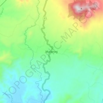
Name: Matanog topographic map, elevation, terrain.

Location: Matanog, Maguindanao del Norte, Bangsamoro, 9613, Philippines (7.42685 124.21857 7.50685 124.29857)

Average elevation: 312 m

Minimum elevation: 5 m

Maximum elevation: 1,051 m

Other topographic maps

Click on a map to view its topography, its elevation and its terrain.
Talitay

Philippines > Maguindanao del Norte

Average elevation: 8 m

Gear up for your next adventure:

🥾Hiking Boots - Sturdy boots providing ankle support and traction on rugged trails
⛺Bushcraft Tarp - Versatile emergency shelter or gear protection
🛏️Camping Sleeping Mat - Comfortable mats for sleeping outdoors
🧰Multitool Knife - Compact and versatile tool for outdoor use
🛰️Satellite Messenger - Emergency communication for areas with no cell service

As an Amazon Associate, this site earns from qualifying purchases at no extra cost to you.