Geolocate

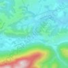
64260 topographic map

Click on the map to display elevation.

About this map

Name: 64260 topographic map, elevation, terrain.

Location: 64260, Louvie-Juzon, Oloron-Sainte-Marie, Pyrénées-Atlantiques, Nouvelle-Aquitaine, France métropolitaine, France (43.09079 -0.41157 43.09089 -0.41147)

Average elevation: 511 m

Minimum elevation: 375 m

Maximum elevation: 1,237 m

Other topographic maps

Click on a map to view its topography, its elevation and its terrain.

Gear up for your next adventure:

⛺Camping Groundsheet - Protect your tent from moisture and dirt
🧥Softshell Hiking Jacket - The perfect balance of wind protection and breathability
🧥Thermal Fleece Jacket - Versatile insulation for changing mountain temperatures
🧢Beanie Hat - Keep your head warm in cold weather
🧰Multitool Knife - Compact and versatile tool for outdoor use

As an Amazon Associate, this site earns from qualifying purchases at no extra cost to you.