
Thank you for supporting this site ❤️
Make a donation
Make a donation
Gear up for your next adventure:
As an Amazon Associate, this site earns from qualifying purchases at no extra cost to you.
Kalakhet topographic map
Click on the map to display elevation.
Thank you for supporting this site ❤️
Make a donation
Make a donation
Gear up for your next adventure:
As an Amazon Associate, this site earns from qualifying purchases at no extra cost to you.
About this map
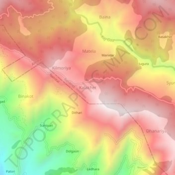
Name: Kalakhet topographic map, elevation, terrain.
Location: Kalakhet, Ranikhet, Almora, Uttarakhand, 263663, India (29.57479 79.34253 29.61479 79.38253)
Average elevation: 1,612 m
Minimum elevation: 997 m
Maximum elevation: 1,988 m
Thank you for supporting this site ❤️
Make a donation
Make a donation
Gear up for your next adventure:
As an Amazon Associate, this site earns from qualifying purchases at no extra cost to you.