
Thank you for supporting this site ❤️
Make a donation
Make a donation
Gear up for your next adventure:
As an Amazon Associate, this site earns from qualifying purchases at no extra cost to you.
Tintern topographic map
Click on the map to display elevation.
Thank you for supporting this site ❤️
Make a donation
Make a donation
Gear up for your next adventure:
As an Amazon Associate, this site earns from qualifying purchases at no extra cost to you.
About this map
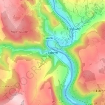
Name: Tintern topographic map, elevation, terrain.
Location: Tintern, Monmouthshire, Wales, NP16 6SY, United Kingdom (51.67801 -2.70088 51.71801 -2.66088)
Average elevation: 139 m
Minimum elevation: -2 m
Maximum elevation: 265 m
Thank you for supporting this site ❤️
Make a donation
Make a donation
Gear up for your next adventure:
As an Amazon Associate, this site earns from qualifying purchases at no extra cost to you.