
Make a donation
Gear up for your next adventure:
As an Amazon Associate, this site earns from qualifying purchases at no extra cost to you.
Otañes topographic map
Click on the map to display elevation.
Make a donation
Gear up for your next adventure:
As an Amazon Associate, this site earns from qualifying purchases at no extra cost to you.
Otañes
Se encuentra situado a aproximadamente 5 kilómetros de la capital municipal, Castro Urdiales. Su censo en el año 2009 lo formaban 680 habitantes (INE), aunque en verano esta población puede llegar a triplicarse. Su altitud es de 217 metros.
Make a donation
Gear up for your next adventure:
As an Amazon Associate, this site earns from qualifying purchases at no extra cost to you.
About this map
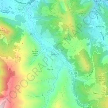
Name: Otañes topographic map, elevation, terrain.
Average elevation: 223 m
Minimum elevation: 9 m
Maximum elevation: 664 m
Make a donation
Gear up for your next adventure:
As an Amazon Associate, this site earns from qualifying purchases at no extra cost to you.