Geolocate

Kanoor topographic map

Click on the map to display elevation.

About this map

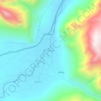
Name: Kanoor topographic map, elevation, terrain.

Location: Kanoor, Sankoo tehsil, Kargil district, Ladakh, India (34.40060 76.03302 34.44060 76.07302)

Average elevation: 3,084 m

Minimum elevation: 2,791 m

Maximum elevation: 3,966 m

Gear up for your next adventure:

🧰Multitool Knife - Compact and versatile tool for outdoor use
🧦Crew Hiking Socks - Comfortable socks for long-distance hikes
🐕Hiking Dog Pack - Let your canine companion carry their own water and food
💡Portable Camping Lamp - Rechargeable lamp for campsite lighting
🛰️Satellite Messenger - Emergency communication for areas with no cell service

As an Amazon Associate, this site earns from qualifying purchases at no extra cost to you.