Geolocate

Rajaudha topographic map

Click on the map to display elevation.

About this map

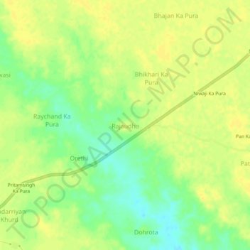
Name: Rajaudha topographic map, elevation, terrain.

Location: Rajaudha, Porsa Tahsil, Morena, Madhya Pradesh, India (26.68486 78.40174 26.72486 78.44174)

Average elevation: 156 m

Minimum elevation: 141 m

Maximum elevation: 163 m

Other topographic maps

Click on a map to view its topography, its elevation and its terrain.

Porsa

India > Madhya Pradesh > Porsa Tahsil > Shahpura No1

Average elevation: 160 m

Arron

India > Madhya Pradesh > Porsa Tahsil > Pipripunth

Average elevation: 153 m

Gear up for your next adventure:

Camping Essentials - All-in-one gear for a comfortable camping trip
🥾Durable Hiking Shoes - Long-lasting shoes for frequent hiking
🥾Lightweight Hiking Shoes - Comfortable shoes for day hikes
🕶️Polarized Sunglasses - Protect your eyes with durable polarized lenses
❄️Traction Ice Cleats - Slip-on spikes for icy trails and winter hiking

As an Amazon Associate, this site earns from qualifying purchases at no extra cost to you.