Geolocate

La Horca topographic map

Click on the map to display elevation.

About this map

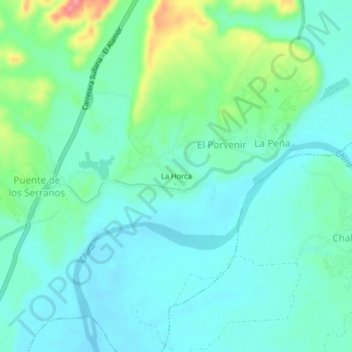
Name: La Horca topographic map, elevation, terrain.

Location: La Horca, El Porvenir, Querecotillo, Sullana, Piura, Perú (-4.80311 -80.61386 -4.76311 -80.57386)

Average elevation: 68 m

Minimum elevation: 45 m

Maximum elevation: 144 m

Gear up for your next adventure:

🔨Vehicle Emergency Tool - Safety tool for remote road trips to trailheads
🥾Trail Hiking Shoes - Durable shoes designed for rugged trails
🧼Biodegradable Camp Soap - Environmentally friendly cleaning for gear and body
🔦LED Flashlight - Powerful and long-lasting flashlight for camping and emergencies
🥾Mountain Hiking Boots - High-traction boots for rocky terrain

As an Amazon Associate, this site earns from qualifying purchases at no extra cost to you.