Geolocate

Santa Justa topographic map

Click on the map to display elevation.

About this map

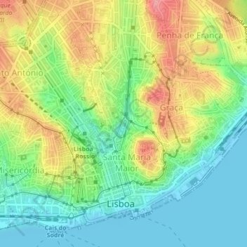
Name: Santa Justa topographic map, elevation, terrain.

Location: Santa Justa, Santa Maria Maior, Lisbon, Portugal (38.71281 -9.14344 38.72017 -9.13486)

Average elevation: 44 m

Minimum elevation: -6 m

Maximum elevation: 110 m

Other topographic maps

Click on a map to view its topography, its elevation and its terrain.

Lisbon

Portugal > Lisbon > Lisbon

Average elevation: 51 m

Gear up for your next adventure:

🥾Trail Running Boots - Durable shoes designed for trail running
🚲MTB Frame Bag - Carry tools and maps directly on your bicycle frame
🧥Insulated Jacket - Keep warm in cold outdoor conditions
🔋Solar Power Bank - Keep your GPS and devices charged during long outdoor trips
🥾Approach Boots - Comfortable boots for hiking and climbing approaches

As an Amazon Associate, this site earns from qualifying purchases at no extra cost to you.