Geolocate

Breckenridge topographic map

Click on the map to display elevation.

About this map
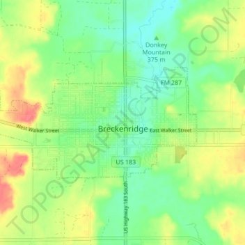
Name: Breckenridge topographic map, elevation, terrain.

Location: Breckenridge, Stephens County, Texas, 76424, United States (32.74423 -98.95102 32.77021 -98.88276)

Average elevation: 377 m

Minimum elevation: 353 m

Maximum elevation: 410 m

Other topographic maps

Click on a map to view its topography, its elevation and its terrain.

Caddo

United States > Texas > Stephens County

Average elevation: 397 m

Breckenridge

United States > Texas > Stephens County

Average elevation: 377 m

Gear up for your next adventure:

🕯️Camping Lantern - Illuminates your entire campsite with high-efficiency LEDs
🧼Biodegradable Camp Soap - Environmentally friendly cleaning for gear and body
🧴First Aid Kit - Essential first aid supplies for outdoor emergencies
🧰Emergency Multi-Tool - Compact multi-tool for outdoor survival
🎒Backpack Rain Cover - External shield to keep your entire pack dry

As an Amazon Associate, this site earns from qualifying purchases at no extra cost to you.