Geolocate

Chantilly topographic map

Click on the map to display elevation.

About this map

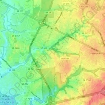
Name: Chantilly topographic map, elevation, terrain.

Location: Chantilly, Fairfax County, Virginia, United States (38.84670 -77.44936 38.91093 -77.36468)

Average elevation: 114 m

Minimum elevation: 67 m

Maximum elevation: 168 m

Gear up for your next adventure:

🥾Lightweight Hiking Boots - Boots for comfort and mobility on long hikes
🧥Thermal Fleece Jacket - Versatile insulation for changing mountain temperatures
🛏️Camping Sleeping Mat - Comfortable mats for sleeping outdoors
🛌Insulated Sleeping Pad - Critical thermal barrier between you and the cold ground
🧦Hiking Socks - Moisture-wicking and comfortable socks for long hikes

As an Amazon Associate, this site earns from qualifying purchases at no extra cost to you.