Geolocate

Jonestown topographic map

Click on the map to display elevation.

About this map

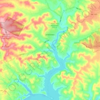
Name: Jonestown topographic map, elevation, terrain.

Location: Jonestown, Travis County, Texas, United States (30.43665 -97.96770 30.52628 -97.89246)

Average elevation: 276 m

Minimum elevation: 197 m

Maximum elevation: 381 m

Gear up for your next adventure:

🔦LED Flashlight - Powerful and long-lasting flashlight for camping and emergencies
🪑Ultralight Camping Stool - Compact seating for rest stops during long hikes
💧Hydration Bladder - Hands-free hydration solution for long treks
🦟Insect Repellent - Keep mosquitoes and black flies away in wooded areas
🥾Trekking Poles - Adjustable trekking poles to reduce knee stress and improve stability

As an Amazon Associate, this site earns from qualifying purchases at no extra cost to you.