Geolocate

Fanlo topographic map

Click on the map to display elevation.

About this map

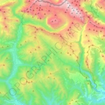
Name: Fanlo topographic map, elevation, terrain.

Location: Fanlo, Sobrarbe, Huesca, Aragon, 22375, Spain (42.48927 -0.09840 42.69472 0.10515)

Average elevation: 1,574 m

Minimum elevation: 633 m

Maximum elevation: 3,328 m

Other topographic maps

Click on a map to view its topography, its elevation and its terrain.

Saravillo

Spain > Aragon > Sobrarbe > Plan

Average elevation: 1,416 m

Gear up for your next adventure:

🥾Approach Shoes - Shoes designed for climbing approaches and rugged trails
📷Outdoor Action Camera - Capture high-elevation views and rugged adventures
🥾Hiking Shoes - Durable and comfortable shoes for trail hiking
🕶️Polarized Sunglasses - Protect your eyes with durable polarized lenses
🧤Insulated Winter Gloves - Heavy-duty protection for sub-zero Canadian adventures

As an Amazon Associate, this site earns from qualifying purchases at no extra cost to you.