Geolocate

Midway topographic map

Click on the map to display elevation.

About this map

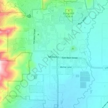
Name: Midway topographic map, elevation, terrain.

Location: Midway, Wasatch County, Utah, 84049, United States (40.48653 -111.50141 40.54107 -111.45099)

Average elevation: 1,751 m

Minimum elevation: 1,656 m

Maximum elevation: 2,164 m

Gear up for your next adventure:

🔋Emergency Crank Radio - Weather alerts and power without needing batteries
❄️Traction Ice Cleats - Slip-on spikes for icy trails and winter hiking
🧦Hiking Liner Socks - Thin base layer to prevent friction and blisters
🪜Heavy Duty Carabiners - Multi-use clips for securing gear to your backpack
🧭GPS Outdoor Watch - Smart watch for navigation and fitness tracking in nature

As an Amazon Associate, this site earns from qualifying purchases at no extra cost to you.