Geolocate

Ponferrada topographic map

Click on the map to display elevation.

About this map

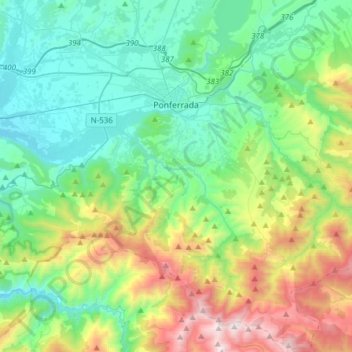
Name: Ponferrada topographic map, elevation, terrain.

Location: Ponferrada, El Bierzo, León, Castile and León, Spain (42.38622 -6.71411 42.61270 -6.40717)

Average elevation: 883 m

Minimum elevation: 424 m

Maximum elevation: 2,136 m

Other topographic maps

Click on a map to view its topography, its elevation and its terrain.

A Corona

Spain > Castile and León > El Bierzo > Candín

Average elevation: 985 m

Gear up for your next adventure:

🌡️Emergency Mylar Blankets - Compact thermal protection for unexpected nights outdoors
🎒Fully Waterproof Backpack - Total protection for photography gear and electronics
🧴Sunscreen SPF - Broad-spectrum sunscreen for outdoor activities
🦯Trekking Poles - Reduced impact on joints for steep topographic climbs
Camping Essentials - All-in-one gear for a comfortable camping trip

As an Amazon Associate, this site earns from qualifying purchases at no extra cost to you.