Geolocate

Ccatahuasi topographic map

Click on the map to display elevation.

About this map

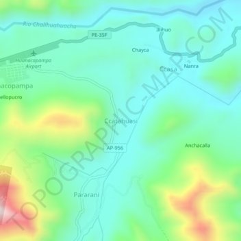
Name: Ccatahuasi topographic map, elevation, terrain.

Location: Ccatahuasi, Challhuahuacho, Cotabambas, Apurímac, Perú (-14.17454 -72.33946 -14.13454 -72.29946)

Average elevation: 3,913 m

Minimum elevation: 3,757 m

Maximum elevation: 4,361 m

Gear up for your next adventure:

Backpacking Tent - Lightweight tent for long-distance hiking trips
🦟Insect Repellent - Keep mosquitoes and black flies away in wooded areas
🛏️Camping Sleeping Mat - Comfortable mats for sleeping outdoors
🧢Hiking Sun Hat - Wide-brimmed protection for exposed mountain ridges
🦌Outdoor Trail Camera - Monitor wildlife activity near your favorite spots

As an Amazon Associate, this site earns from qualifying purchases at no extra cost to you.