
Thank you for supporting this site ❤️
Make a donation
Make a donation
Gear up for your next adventure:
As an Amazon Associate, this site earns from qualifying purchases at no extra cost to you.
Sotuélamos topographic map
Click on the map to display elevation.
Thank you for supporting this site ❤️
Make a donation
Make a donation
Gear up for your next adventure:
As an Amazon Associate, this site earns from qualifying purchases at no extra cost to you.
About this map
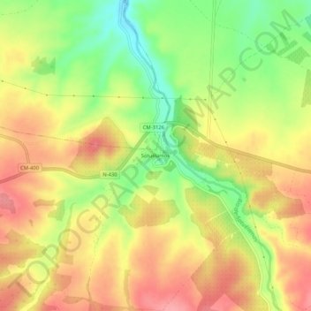
Name: Sotuélamos topographic map, elevation, terrain.
Location: Sotuélamos, El Bonillo, Albacete, Castilla-La Mancha, España (39.02084 -2.59268 39.06084 -2.55268)
Average elevation: 885 m
Minimum elevation: 828 m
Maximum elevation: 930 m
Thank you for supporting this site ❤️
Make a donation
Make a donation
Gear up for your next adventure:
As an Amazon Associate, this site earns from qualifying purchases at no extra cost to you.