
Punta Negra topographic map
Interactive map
Click on the map to display elevation.
About this map
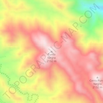
Name: Punta Negra topographic map, elevation, terrain.
Location: Punta Negra, Valle Fértil, San Juan, Argentina (-30.89434 -67.49382 -30.89424 -67.49372)
Average elevation: 1,901 m
Minimum elevation: 1,538 m
Maximum elevation: 2,124 m
Other topographic maps
Click on a map to view its topography, its elevation and its terrain.
Las Lomitas
Argentina > San Juan > Las Lomitas
Las Lomitas, Albardón, San Juan, Argentina
Average elevation: 625 m
Villa San Justo
Argentina > San Juan > Villa San Justo
Villa San Justo, Rivadavia, San Juan, 5407, Argentina
Average elevation: 699 m
Cerro Santa Lucía
Cerro Santa Lucía, Iglesia, San Juan, Argentina
Average elevation: 4,217 m