Geolocate

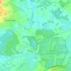
Farven topographic map

Click on the map to display elevation.

About this map

Name: Farven topographic map, elevation, terrain.

Location: Farven, Samtgemeinde Selsingen, Landkreis Rotenburg (Wümme), Lower Saxony, Germany (53.41215 9.23137 53.47189 9.34655)

Average elevation: 23 m

Minimum elevation: 8 m

Maximum elevation: 36 m

Other topographic maps

Click on a map to view its topography, its elevation and its terrain.

Gear up for your next adventure:

💧Reusable Water Bottle - Durable water bottles for hydration on trails
🔦LED Headtorch - Bright and durable light for night activities
🥾Trekking Poles - Adjustable trekking poles to reduce knee stress and improve stability
🕶️Polarized Sunglasses - Reduces glare from snow and water at high elevations
🧰Survival Kit - Essential gear for emergencies in the wilderness

As an Amazon Associate, this site earns from qualifying purchases at no extra cost to you.