Geolocate

Janapahad topographic map

Click on the map to display elevation.

About this map
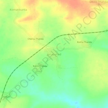
Name: Janapahad topographic map, elevation, terrain.

Location: Janapahad, Palakeedu mandal, Suryapet, Telangana, India (16.72475 79.70570 16.76475 79.74570)

Average elevation: 77 m

Minimum elevation: 55 m

Maximum elevation: 98 m

Gear up for your next adventure:

🔦UV Flashlight - Detect minerals or specific insects in the dark
🥾Trekking Poles - Adjustable trekking poles to reduce knee stress and improve stability
🧤Thermal Hiking Gloves - Grip-enhanced gloves for cold-weather altitude trekking
🏕️Camping Hammock - Integrated protection for sleeping between trees
🛌Insulated Sleeping Pad - Critical thermal barrier between you and the cold ground

As an Amazon Associate, this site earns from qualifying purchases at no extra cost to you.